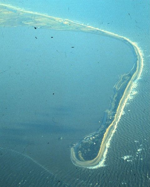

Spurn Point, situated at the mouth of the Humber Estuary in Yorkshire, has been a vital part of the UK’s defences since the early nineteenth century and especially during the First World War. Now a nature reserve, the delicate spit of land is only 50 meters wide at some points as waves are constantly pushing the land southwards, meaning many of the military installations have fallen into the sea.
Defence installations on the point date back to the Napoleonic Wars, with a gun battery and barracks established there around 1805. But when the First World War broke out, military activity in the area soared and dominated it like never before. Within 12 hours, the small village of Kilnsea at the peak of the peninsula became home to a garrison consisting of some 500 troops.
One Kilnsea resident, Ernie Norwood, who was eight years old when the war began, recalled the militarisation of the area in his memoirs and referring to the fear that villagers felt when German Zeppelin airships flew overhead on their way to bomb Hull, claimed “Sometimes they were only about 50 feet high when they passed over Kilnsea.” As the war progressed, further defences were built along Spurn Point to maintain its safety.
However, the debris that is left behind from the war on the beach today poses problems for the peninsula’s ecosystem. Andrew Gibson, the reserve’s manager for Yorkshire Wildlife Trust, claims that the trust faced the dilemma of finding a balance between trying to preserve the military history of the area, and letting nature run its course. “The legacy of what was holding a line defending Britain is now fixing something that probably shouldn’t be fixed. The very nature of what Spurn is means that it needs to be allowed to move.”