Babylonian town plan

The world’s oldest city plan is around 3,500 years old and shows part of the town of Nippur (in modern Iraq). It is inscribed on a clay tablet and shows the river Euphrates, several temples and part of the city walls.
Hereford Mappa MundI

The Hereford Mappa Mundi is the largest surviving medieval map (measuring around 1.58m X 1.33 metres). It has hundreds of place-names and pictures of fabulous creatures, but the compiler labelled Europe and Africa the wrong way round
Booth Poverty Map

Reformer Charles Booth’s maps of poverty in Victorian London were among the first attempts to use maps to visualize social trends. The first volume showed that 35 per cent of the population of the East End lived in abject poverty.
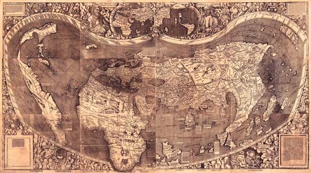
Waldseemüller Map

The first map to use the term “America” for the New World was Martin Waldseemüller’s 1507 world map. The single surviving copy is also the world’s most expensive map; it was bought by the US Library of Congress in 2003 for $10 million.
Google Maps

Google Maps has captured 20 million petabytes of data (about 21 million gigabytes) since the application was launched in 2005. This would fill the hard-drives of around 40,000 average-capacity laptop computers.
The Times History of the World in Maps is out now, priced £50. Find out more at www.timesatlas.com